
Mapping the Way to Effective Evacuations

An evacuation plan is only as effective as people's ability to understand and act on it. For evacuation planners responsible for hospitals, airports, shopping malls, universities, and large commercial facilities, this presents a critical challenge: how do you turn a building's evacuation procedures into clear, actionable guidance for everyone inside?
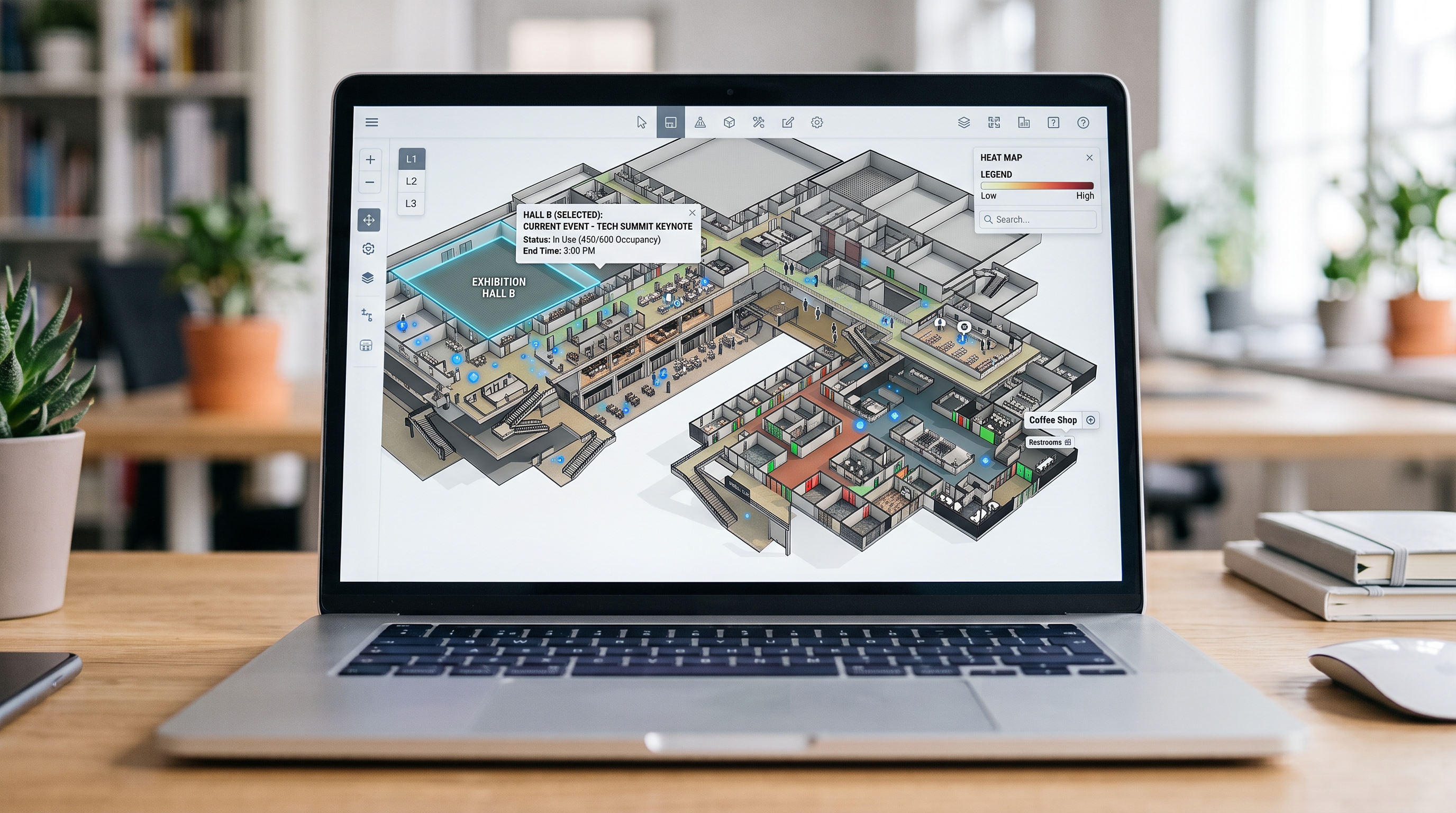
Digital maps offer a practical answer. More than a digital version of a floor plan, they provide the spatial foundation that connects evacuation routes, emergency exits, hazard zones, and safe assembly points into one navigable environment.
From Static Floor Plans to Actionable Evacuation Plans
Traditional evacuation plans rely heavily on printed diagrams and fixed signage. While essential, these tools can be difficult to interpret in unfamiliar or complex environments, particularly when occupants need to navigate multiple floors, corridors, and exit points under pressure.
For evacuation planners, the challenge is not simply identifying emergency exits. It is ensuring that people can find them, understand the route, and reach safety without unnecessary confusion.
A digital map makes this information interactive and easier to navigate. It can represent the facility's layout, connect indoor spaces across floors, and display critical evacuation infrastructure in context. This gives planners a clearer way to translate documented procedures into guidance that occupants can follow.
Five Ways Digital Maps Strengthen Evacuation Planning
1. Mapping the Entire Evacuation Network
Effective evacuation planning begins with an accurate understanding of the building. A digital map brings together corridors, stairwells, emergency exits, refuge areas, and assembly points in a connected spatial model.
This helps planners examine route connectivity, identify potential bottlenecks, and assess how occupants can move from different areas toward designated safe destinations.
2. Making Evacuation Routes Easier to Follow
An evacuation route may be technically correct on paper but difficult for an unfamiliar visitor to follow. Digital wayfinding can provide step-by-step directions that guide occupants through complex buildings, including floor transitions and connections between different sections of a facility.
Instead of interpreting a floor plan independently, users can receive clear visual guidance from their location toward a designated exit.
3. Supporting Alternative Routes During Emergencies
An emergency can render a normally accessible route unsafe. A blocked corridor, fire, or other localized hazard may require occupants to use an alternative exit.
When integrated with authorized emergency management systems, digital maps can help planners communicate affected areas and display alternative routes that have been verified as safe. This creates a foundation for more responsive evacuation guidance without relying solely on static instructions.
4. Addressing Accessibility and Diverse Occupants
Evacuation plans must account for people with different mobility, sensory, and language needs. Digital maps can support accessible route information, multilingual instructions, and visual or audio guidance.
They can also identify designated refuge areas and accessible evacuation provisions established by the facility's safety procedures. These capabilities help planners design more inclusive evacuation strategies while complementing trained personnel and appropriate physical safety measures.
5. Improving Drills, Reviews, and Preparedness
Digital maps are valuable before an emergency occurs. Planners can use them to review evacuation routes, communicate procedures, support staff training, and prepare for different emergency scenarios.
Maintaining an accurate digital representation of the facility also helps ensure that changes to building layouts, exit locations, or designated safe areas are reflected in evacuation information.
Connecting the Map to the Wider Emergency Response System
The greatest potential comes when digital maps are connected to the systems that support emergency operations. Integrations with fire alarm systems, building management platforms, access control, and emergency communications can help authorized teams coordinate information and responses.
Indoor positioning technologies can also support location-aware guidance where suitable infrastructure is available. However, these capabilities depend on reliable integrations, validated safety procedures, and appropriate infrastructure.
A digital map does not independently detect hazards or determine whether an exit is safe. Evacuation planners must establish the rules, validate routes, and ensure that any dynamic guidance reflects verified emergency information.
Digital guidance must also complement approved evacuation procedures, physical signage, emergency responder instructions, and contingency arrangements for power or connectivity failures.
Make Digital Mapping Part of the Planning Process
For evacuation planners, digital mapping should not be an afterthought added once an evacuation plan is complete. It should be considered from the beginning, alongside building layouts, occupant needs, emergency scenarios, and operational procedures.
A well-maintained digital map creates a common spatial reference for planners, facility managers, emergency teams, and building occupants. It helps bridge the gap between knowing where safety measures are located and understanding how to reach them.
An evacuation plan defines the path to safety. A digital map helps make that path understandable, accessible, and actionable.
Featured Success Stories
See how businesses like yours are leveraging Nearmotion to createimpactful indoor experiences.




Send Us a Message
Fill out the form below, and our team will get back to you shortly.





Find Your Perfect Solution
Ready to transform your retail space? NEARMOTION offers tailored solutions. Discuss with an expert or start building your map for free.