
Build an Indoor Map in 1 minute

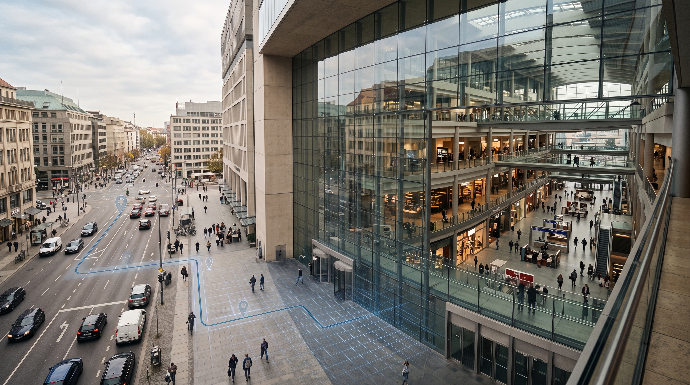
Navigating a large building shouldn't be complicated. Yet in hospitals, airports, shopping malls, and universities, visitors often struggle to find the right room, department, or facility. This leads to missed appointments, repeated questions at reception desks, and unnecessary frustration, particularly for people unfamiliar with the building.
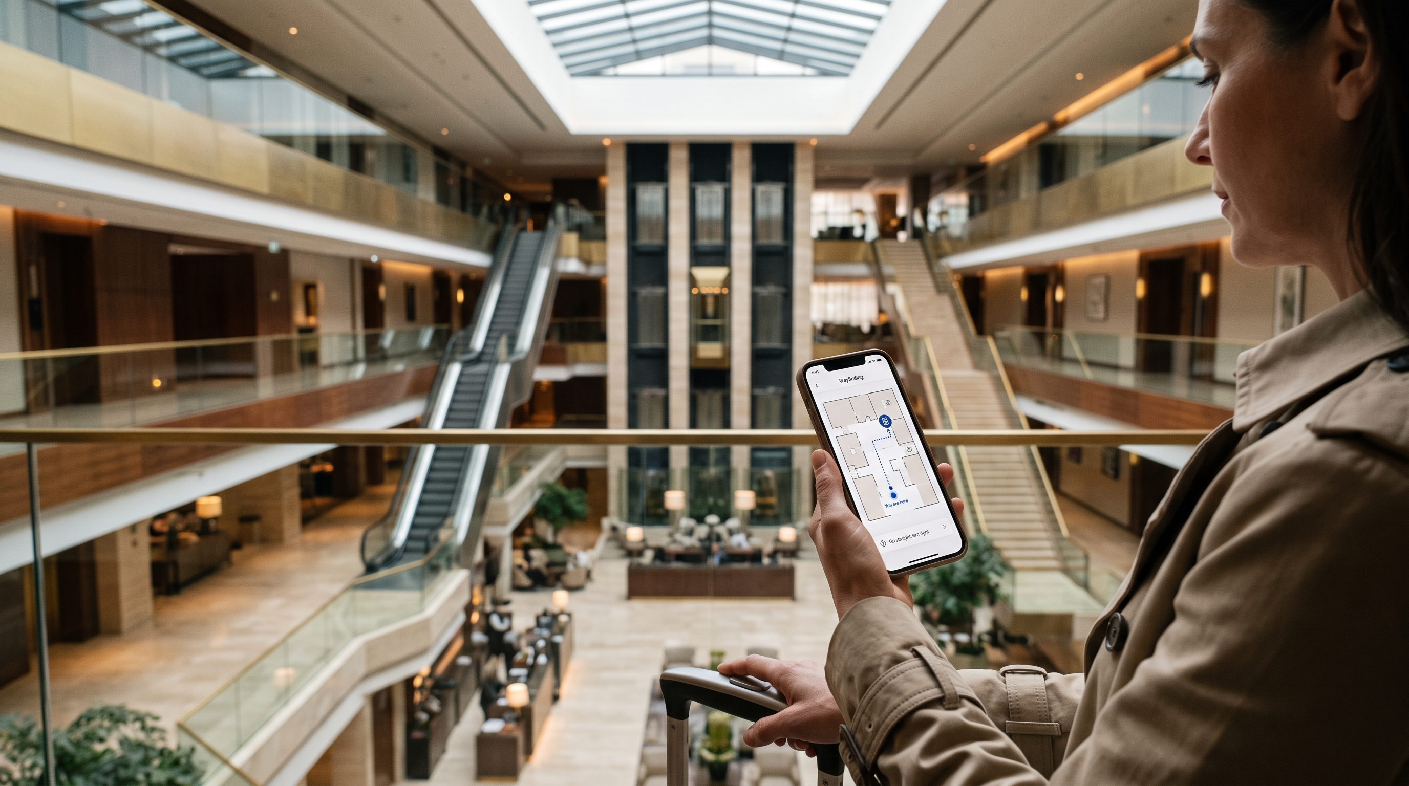
An interactive indoor map makes navigation easier. Visitors can search for a destination, view its location, and follow step-by-step directions using their smartphones or interactive kiosks.
But creating an indoor map traditionally requires considerable manual work, from tracing walls and defining rooms to placing doors and building navigation routes.
With NEARMOTION AI Map, this process becomes significantly faster. By uploading a floor plan, you can generate the initial digital representation of a floor in approximately one minute. AI handles much of the drawing, leaving you to review, refine, and prepare the map for visitors.
Why Buildings Need Interactive Indoor Maps
An indoor map is more than a digital version of a building's floor plan. It gives visitors a practical way to understand their surroundings and reach their destinations.
Key benefits include:
- Simpler navigation: Visitors can search for rooms, departments, shops, and facilities instead of relying on signs or asking for directions.
- Reduced pressure on reception teams: Clear directions help minimize repetitive questions and allow staff to focus on other responsibilities.
- Improved accessibility: Visitors can locate essential facilities, including restrooms and accessible services, more easily.
- Multilingual experiences: Provide navigation in Arabic and English to accommodate different visitor groups.
- Valuable visitor insights: Search activity and navigation data can help building operators understand destination demand and improve the visitor experience.
What You Need to Get Started
Before creating your indoor map, prepare a floor plan for each floor of your building.
NEARMOTION AI Map supports several common formats:
- DWG and DXF CAD files.
- Vector PDF files.
- PNG and JPG images.
For the best results, keep the following recommendations in mind:
- One floor per file or page: Avoid combining multiple floors in a single drawing.
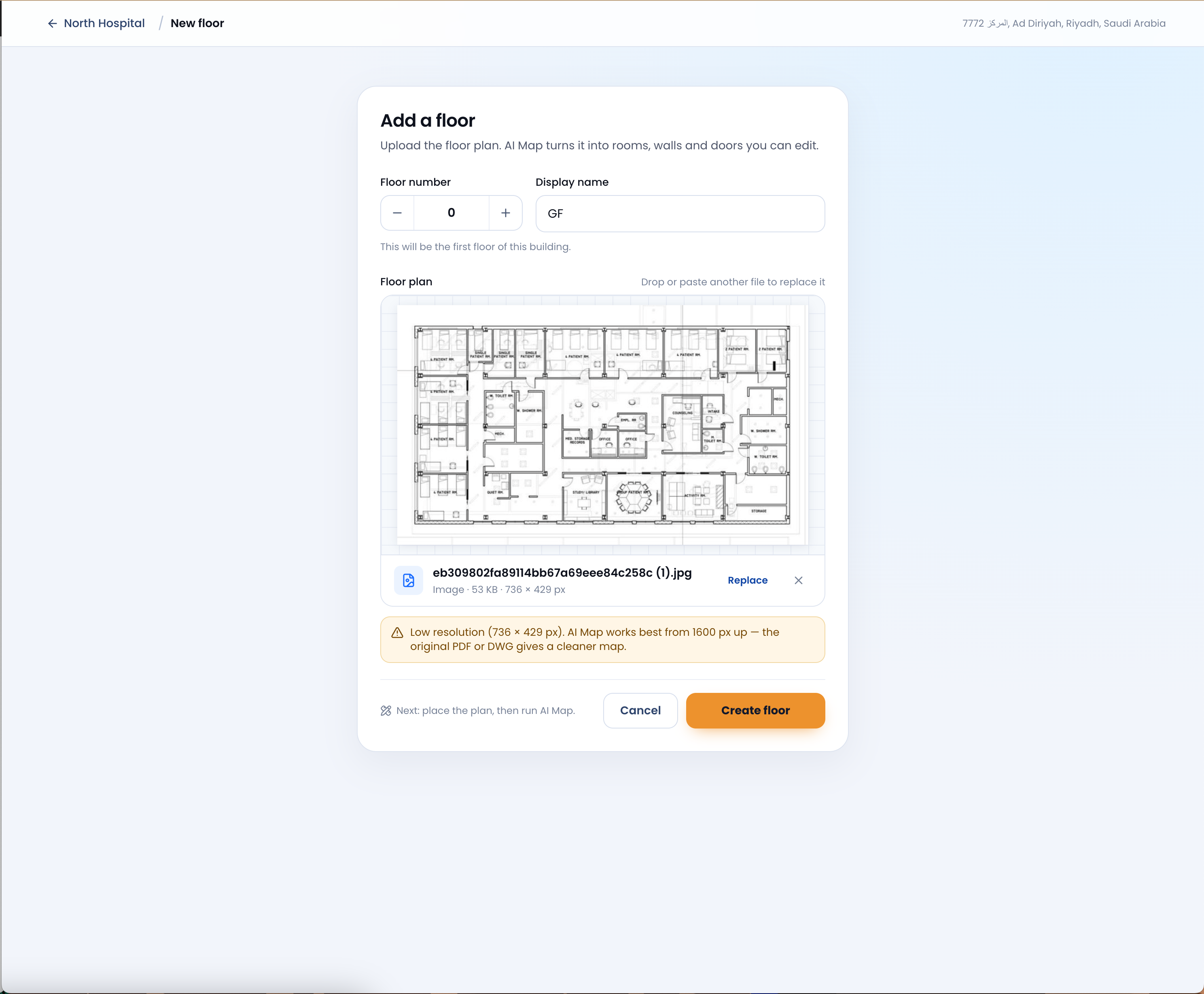
- Image resolution: Use images at least 1,600 pixels wide for better recognition.
- Readable room labels: Make sure room names and numbers are clearly visible, as AI Map uses them to identify and label spaces.
- Clean floor plans: Avoid photographs of printed drawings, blurry scans, and plans with excessive annotations.
A clean, well-prepared floor plan helps AI Map produce a more accurate initial result.
How to Create an Interactive Indoor Map
The process takes place in NEARMOTION Map Studio, where you can create your building, upload floor plans, generate the map, configure navigation, and publish the result.
Step 1: Create Your Project and Building
Start by creating a project for your site, such as a hospital, university, or shopping mall.
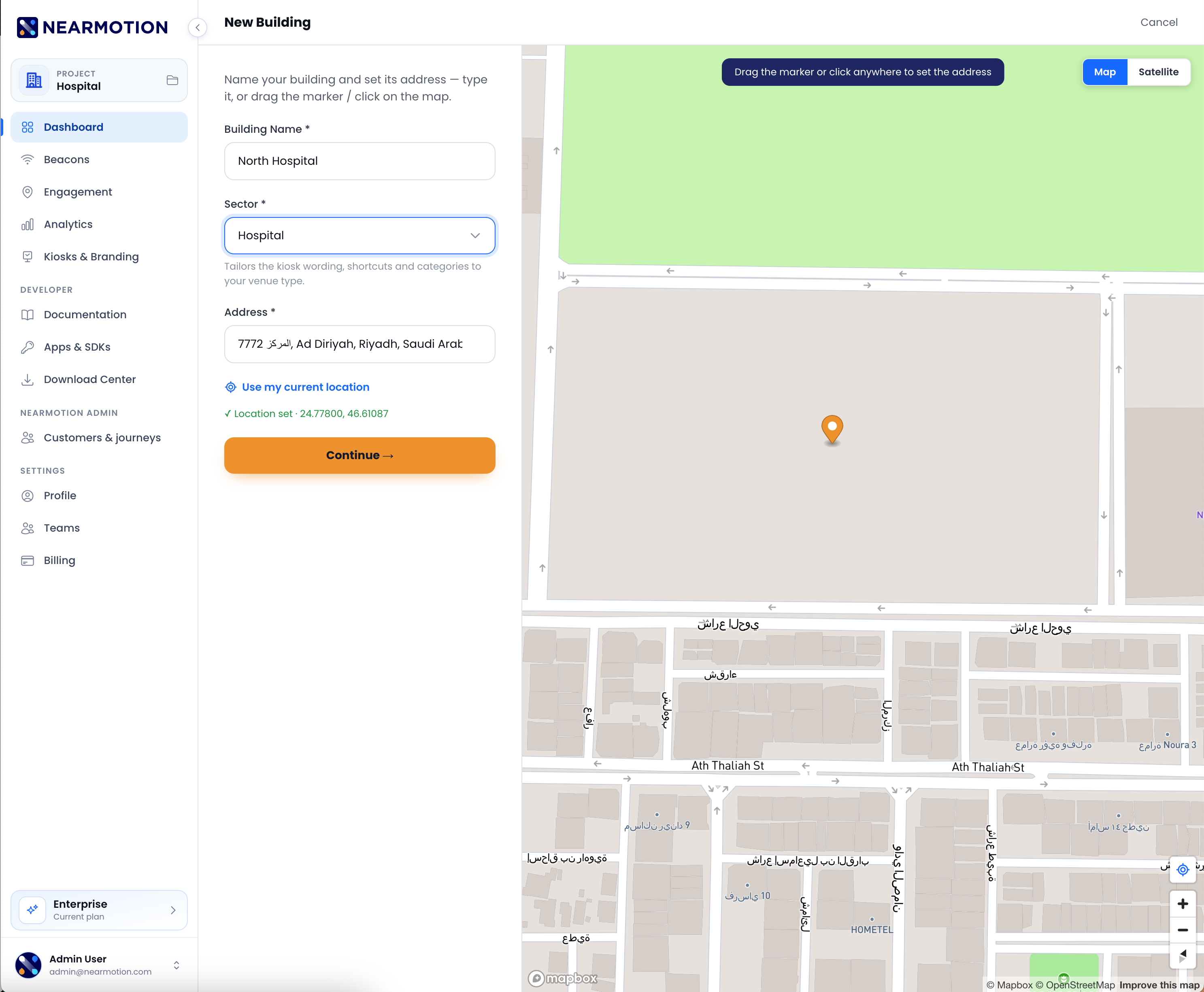
Next, add a building and enter its basic information, including its name, sector, and address. Locate the building on the map and adjust the location marker to match its exact position.
This establishes the building within its geographical context and provides the foundation for indoor mapping.

Step 2: Upload Your Floor Plan
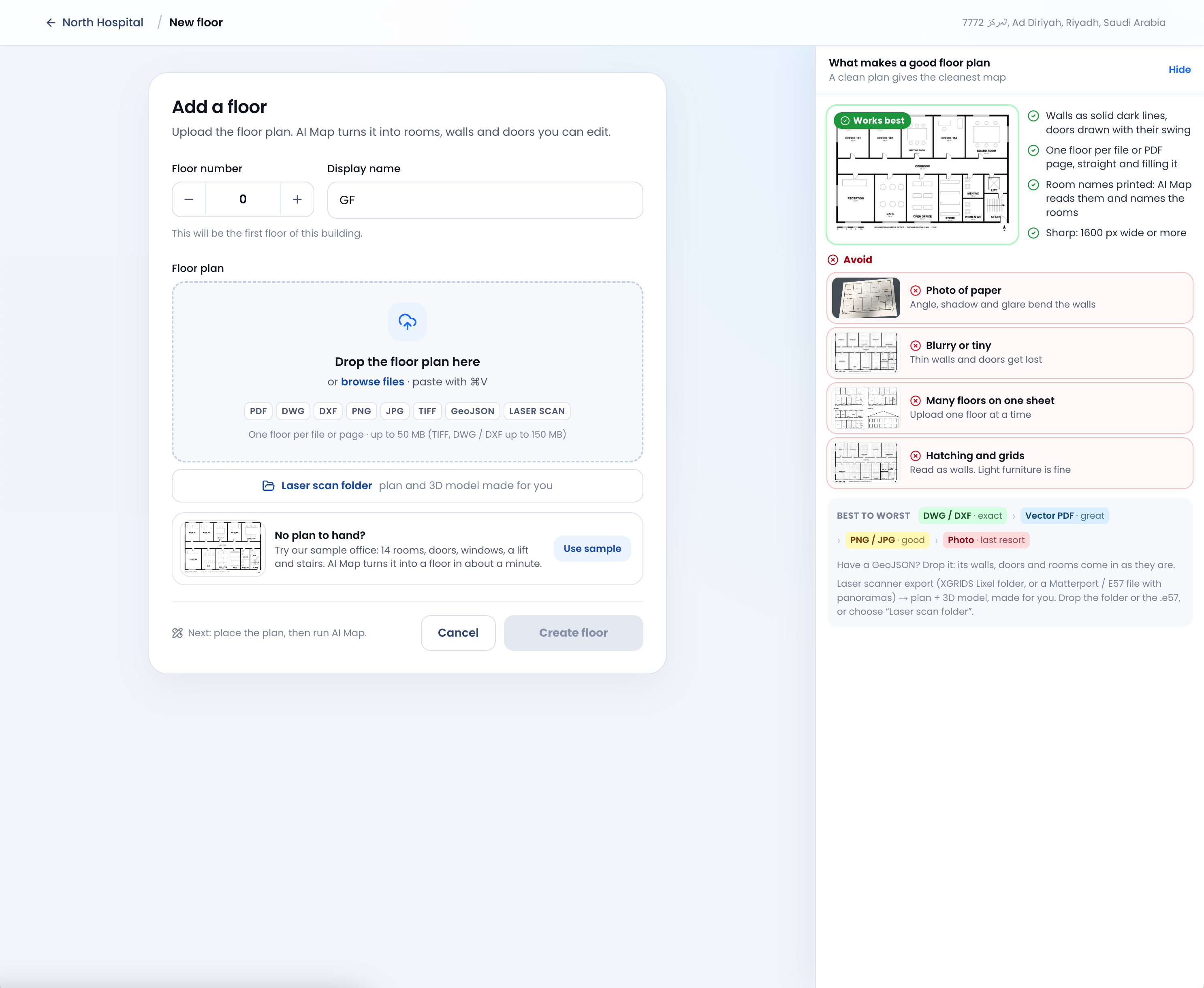
Add a new floor by entering its floor number and name, such as Ground Floor (GF), First Floor (FF), or Basement (B1).
Upload the corresponding floor plan and review the preparation guidelines displayed in the platform before proceeding.
Each floor is configured independently, making it easier to manage multi-floor buildings.
[Screenshot: Add floor form and floor plan preparation tips]
Step 3: Generate the Map with AI Map
This is where the process becomes significantly faster.
Once the floor plan is uploaded, position it on the map and align it using two reference points. You can adjust its opacity to make the drawing easier to compare with the underlying map.
Then, run AI Map.
In approximately one minute, the AI processes the floor plan and generates the initial indoor layout, identifying and drawing elements such as:
- Walls and room boundaries.
- Doors and windows.
- Individual rooms and spaces.
- Room names and labels extracted from the floor plan.
Once processing is complete, use the Select tool to inspect the generated elements and correct any inaccuracies.
Instead of manually drawing the entire floor from scratch, you now have a structured digital map ready for refinement.


Step 4: Create the Navigation Routes
A digital floor plan becomes a navigation solution when visitors can move between destinations.
Open the Routes tool to create the navigation network. You can draw paths directly on the map by selecting points along corridors and connecting different areas.
When one path connects to another, the segments join to form a continuous network.
Alternatively, use the Generate function to create routes automatically. Review the generated connections and resolve any elements flagged for checking before proceeding.
Accurate route configuration is essential to ensure visitors receive clear directions between their starting point and destination.

Step 5: Customize the Map Appearance
Once the layout and routes are ready, configure how the map will appear to visitors.
The View panel allows you to customize the visual presentation, including:
- Map style and appearance.
- Wall and door colors.
- Base map visibility.
- Available map layers.
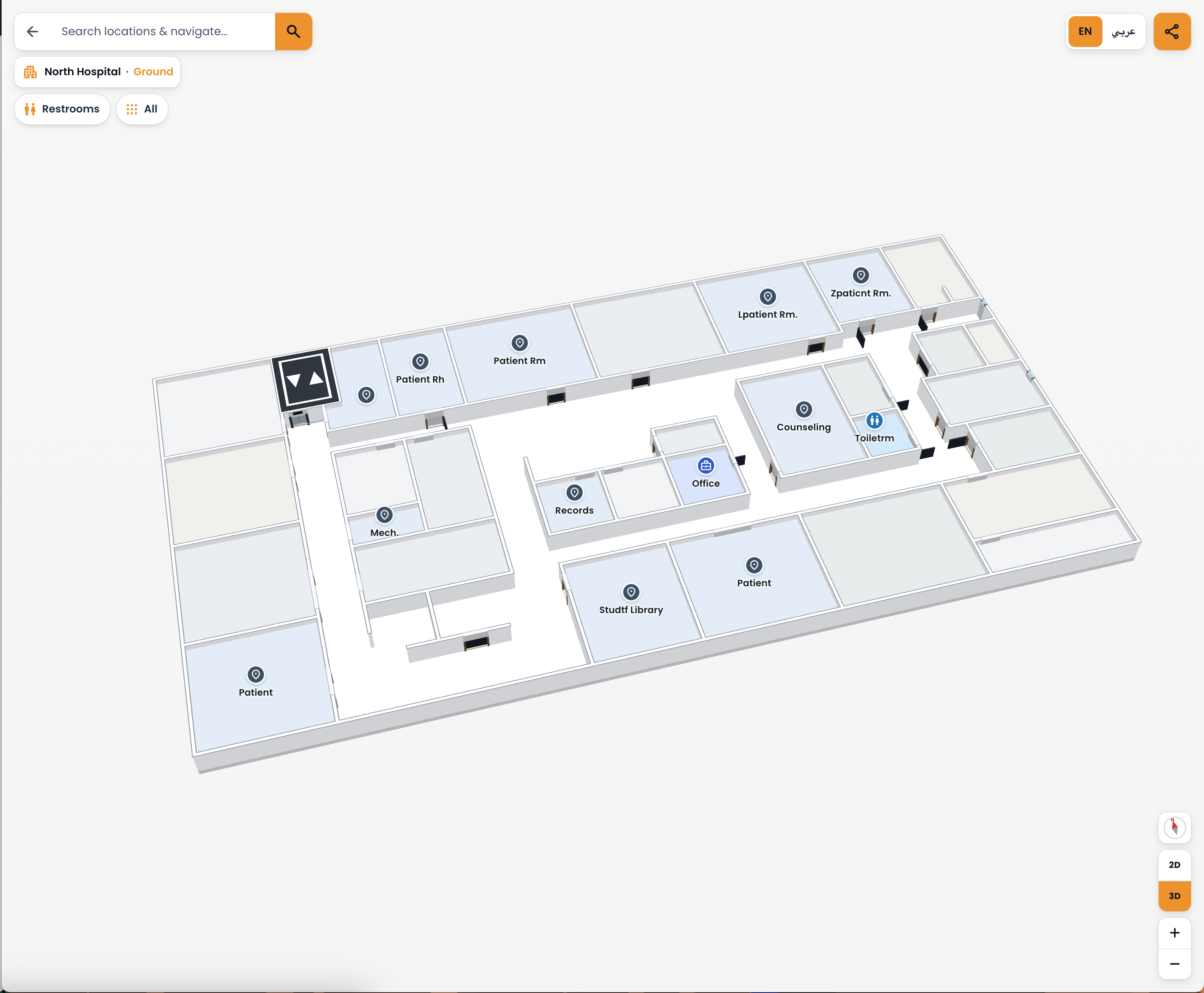
You can also switch to 3D view to inspect the building from a perspective closer to the visitor experience.
This helps ensure the map is both functional and visually easy to understand.

Step 6: Publish Your Indoor Map
After reviewing the floor layout, navigation routes, and visual settings, click Publish.
Your interactive indoor map is now ready to be accessed by visitors.
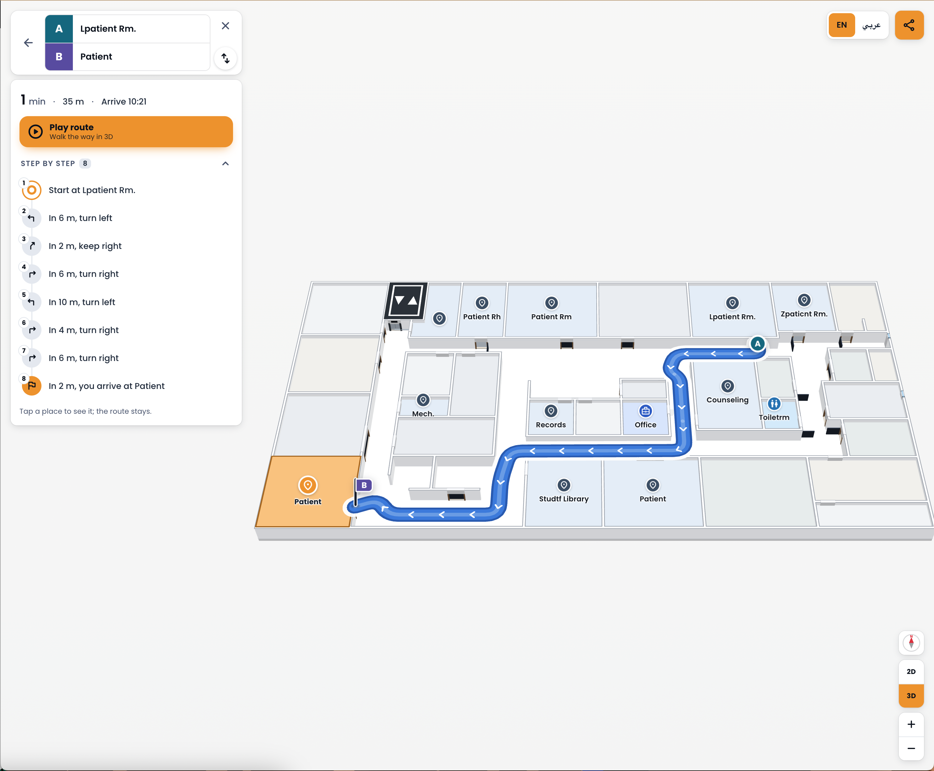
They can search for destinations, locate important facilities such as restrooms, and follow turn-by-turn directions to reach their selected location.
Navigation instructions provide clear guidance at each stage, such as:
In 6 metres, turn left.
From a Floor Plan to a Better Visitor Experience
Imagine a patient arriving at a hospital for an appointment. Instead of asking reception where to find the counselling department, they open the indoor map, search for "Counselling," and select their destination.
The map displays the route, indicates the distance to each turn, and guides them through the building. They can also switch to 3D to better understand the surrounding corridors and spaces.
What once required extensive manual drawing can now begin with a floor plan and approximately one minute of AI processing.
Of course, generating the initial map is only part of the process. Reviewing room labels, checking connections, validating navigation routes, and preparing the visitor experience remain important steps.
The result is a practical, interactive digital map that helps visitors navigate complex buildings while giving facility operators a better way to manage and improve the indoor experience.
Want to see what your building could look like as an interactive indoor map?
Contact the NEARMOTION team to explore AI-powered indoor mapping and visitor navigation for your facility.
Featured Success Stories
See how businesses like yours are leveraging Nearmotion to createimpactful indoor experiences.



Send Us a Message
Fill out the form below, and our team will get back to you shortly.





Find Your Perfect Solution
Ready to transform your retail space? NEARMOTION offers tailored solutions. Discuss with an expert or start building your map for free.